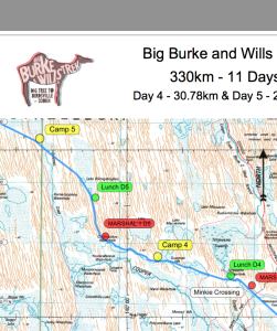

SERVICES
- Custom maps
- Course design, layout.
- Distance measuring.
- Elevation profiles.
- GPS course checking.
- Maps can be produced for print, navigation tablet or computer use.
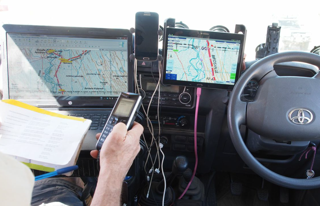
COURSE RECCE, DISTANCE CHECKING
- Full screen moving map with GPS for site and course checking
- Distance accuracy checking for all terrain types
REAL-TIME MOVING MAPS
- Laptops and tablets with real-time moving maps to aid course setters, support vehicles and event directors.
- Moving maps can be provided to response teams to help with emergencies.
- Electronic course track plots and kilometre markers suitable for course marking crew use on smart phones or small tablets (gpx or iml files).
Devices can be mounted in cars, bikes, helicopters or for walkers.