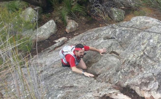
ESS is providing medical and safety teams, a radio network and input into course selection and mapping for the Mount Barney Skyrunning event https://www.facebook.com/barneysbluffwhich will take place in southern Queensland in August 2015. Here, Race Director Sean Greenhill climbs the South Ridge on a recent recce trip with ESS where the course was checked out and a location for a radio repeater was established.
Monthly Archives: November 2014
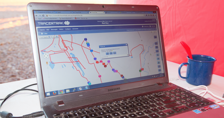
Satellite tracking of participants
Over two years ESS has worked with satellite tracking systems that follow individual runners or trekkers with on-screen updates at event HQ every ten minutes. These systems give event organisers excellent supervision of participants for safety purposes. They also have a HELP button for emergencies. This photo shows satellite tracking in use at the Big Red Run 2014.
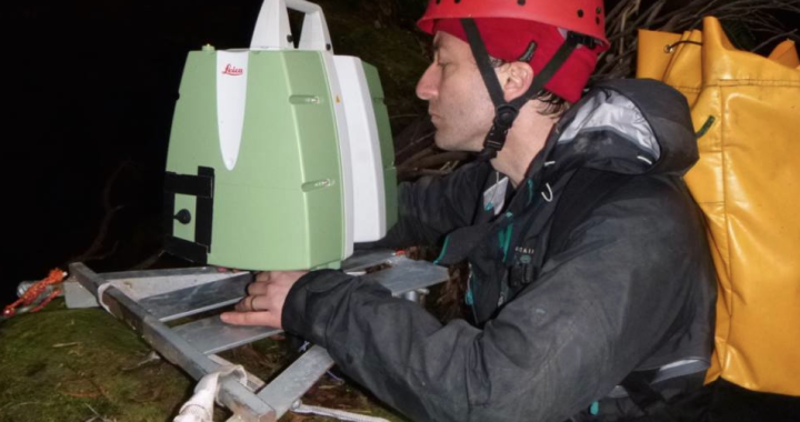
Claustral Canyon 3D laser scanning
In March 2014 an ESS crew supported film makers Luke Farrer and Michael Breer as they made a 3D scanned model of Claustral. This involved three weeks in the canyon where staff coordinated the rigging, grips and safety and made a camp for the crew.
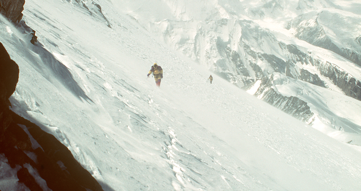
Mt Chongtar 7440m
Mt Chongtar expedition, 1994, at 7440m this was one of the highest unclimbed mountains on earth. The small team comprised Greg Mortimer, Colin Monteath and Lucas Trihey.
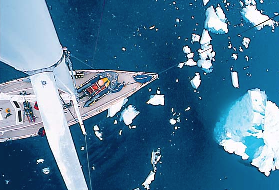
Antarctic Peninsula expedition
Over the summer of 1999/2000 we chartered a yacht and led an expedition to climb and ski on the Antarctic Peninsula.
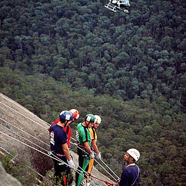
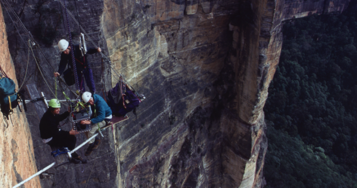
Filmed-for-TV sporting events
Test of the Toughest was a sports series where we were involved with course design, rigging and safety. These Kellogs Ironmen are just about to start a 120m abseil down the slabs at Booroomba Rocks in the ACT.
Film crew support since 1994
We’ve been working with film and TV crews since the 90s when we worked with Imax film maker John Weiley for a couple of months filming in the Blue Mountains, NSW.
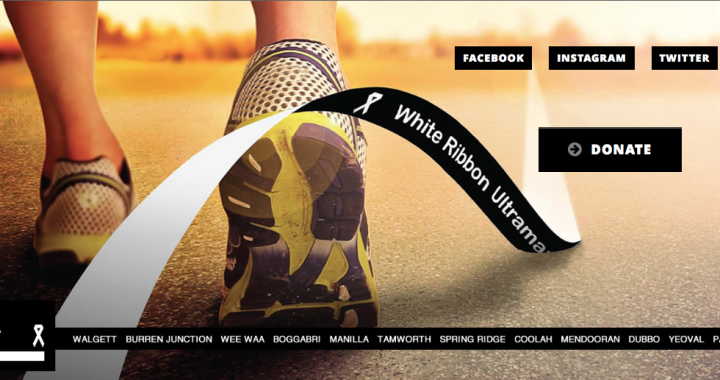
White Ribbon Ultramarathon
We are proud to support the White Ribbon Ultramarathon that starts on Friday 14th November. Kirrily Dear will run 860km over 12 days. Check the website to donate and help put a stop to violence against women.
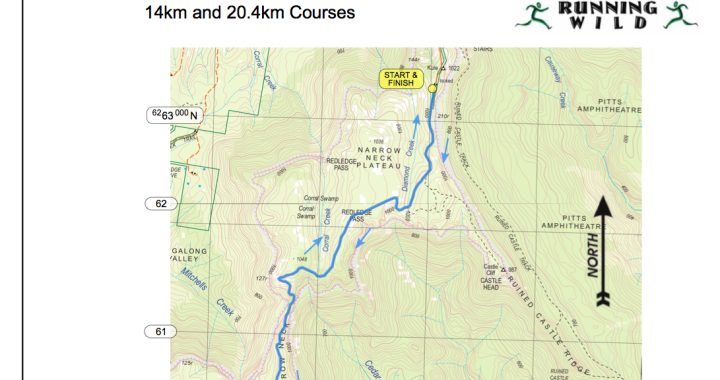
mapping department news
ESS now produces high resolution topo maps with UTM coordinates and a custom overlay of the event course, marshal locations and other details. This sample snippet is for the Running Wild Narrowneck 20km Night Run on Saturday.
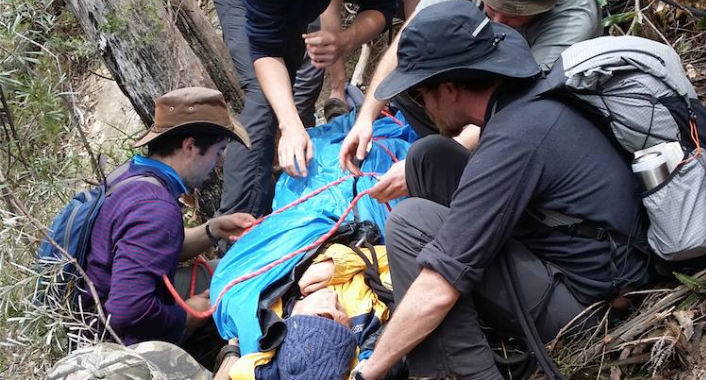
Nov 2014 Expedition Medicine Course
Four enjoyable days helping deliver a course for 25 medical professionals at the Expedition Medical Course course in the Blue Mountains. ESS presented on expedition planning, comms, first response and set up a search and rescue training scenario.