Basic Instructions (for tech-savvy users)
Install the Avenza Maps app and open it.
Import the event map into the app – the mapping file you require can be found on the Event Geo Files page.
Full Step-By-Step Instructions
Installing & Opening Avenza Maps
- Open the Play Store app on your smartphone.
- Make sure you are in the Apps tab of the Play Store before typing “Avenza Maps” into the search bar.
- Find the ‘install’ button and press it- it will take a few minutes to install depending on your internet connection. If you already have the app, check for any updates in the Play Store App.
- Once installed, open the Avenza Maps app.
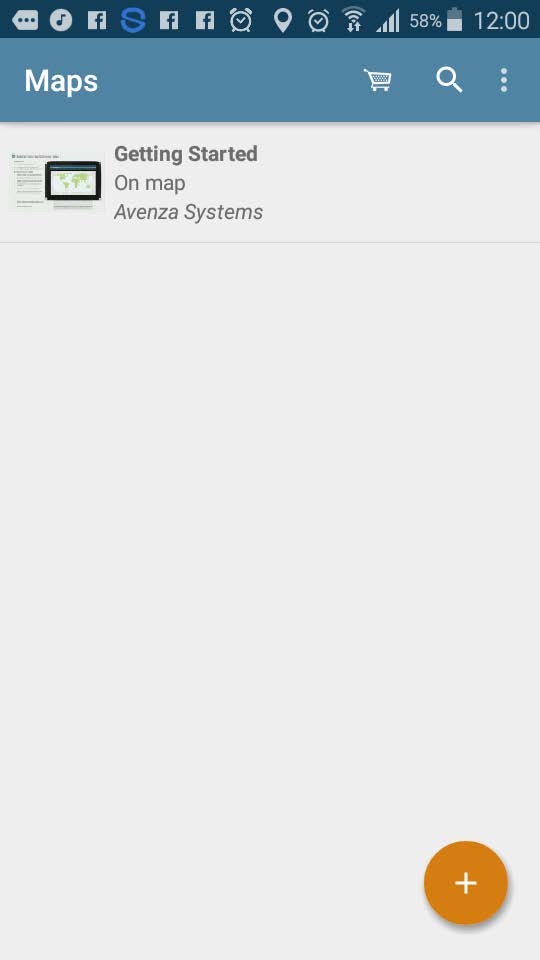
- Press “x” on the screen that says “sign in” and “I’m new”.
- You will find yourself on the “My Maps” screen (image below).
Importing the Event Map
- Open the Event Geo Files page on the ESS Website in the browser on your smartphone.
- Locate the mapping file you require and copy the link below the relevant title (long press on top of the link & select “copy”).
- Go to your Avenza Maps app
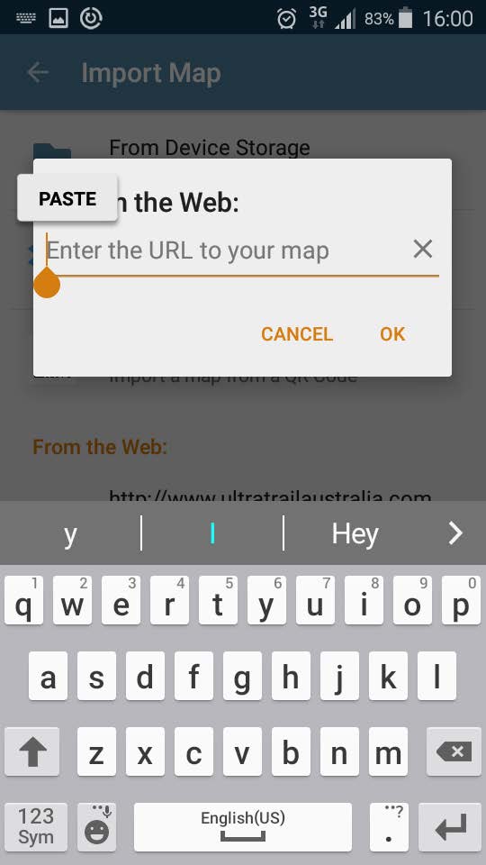
- Click the orange “+” button
- Tap “download or import a map”
- Tap “http://” at the bottom of screen
- Paste the link you copied earlier (long press and select “paste”)
- Press “OK”
- After the map has finished processing, tap to open.
Using Avenza Maps
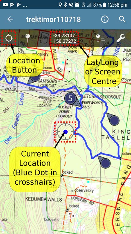
- To make full use of Avenza maps, GPS must be turned on in your device. See troubleshooting if you need help with this*
On the map, key locations are marked with black lines & different coloured labels. The course route is shown as a blue line for the 101km course only, pink line for the 101km and 50km shared course, and purple line for the 101km, 50km, and 25 km shared course. - The latitude and longitude numbers (top of the screen) correspond to the point that the cross-hairs are targeting at centre screen.
- Therefore, you can scroll around to any position on the map & determine the co-ordinates of the location between the cross-hairs.
- Your current GPS location is displayed on the map as a blue dot.
- Press the Location Button to centre in on your current location. Once this is done, you’ll know YOUR current lat/long coordinates. This will only work if you are physically located within the map boundaries.
Troubleshooting
*Devices with an inbuilt GPS chip (most smart phones and tablets) can determine your geographical position using GPS (Global Positioning System). This does not rely on having mobile reception. Follow the instructions below if you don’t know how to turn on GPS.
How to activate or deactivate the GPS function:
- Go to “Settings”
- Scroll down until you find “Location Access” or “Location Services”
- Find option that allows apps to use GPS satellites to pinpoint your location. Press the checkbox, or indicator, next to this to activate or deactivate the GPS.
These instructions are general and may vary slightly depending on your brand and model of device. If they don’t provide you with enough information try using your device’s user manual and/or do a web search to get more information.